


Hurricane Lee’s threat to portions of New England and Atlantic Canada is growing, with a track closer to the coast becoming more likely and a massive wind field which could reach these areas regardless of where the storm finally tracks later this week and this weekend.
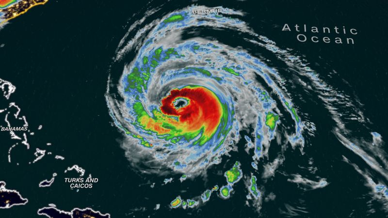
The massive storm, which remains a Category 3 hurricane as of Wednesday morning, continued to churn northwest in the open Atlantic and was about 460 miles south-southwest of the island with maximum sustained winds of 115 mph, according to the latest update from the National Hurricane Center.
A tropical storm warning remains in effect for Bermuda ahead of Lee’s brush with the island.
“On the forecast track, the center of Lee will pass west of Bermuda Thursday and Thursday night and then approach the coast of New England or Atlantic Canada late this week,” the hurricane center said in its 5 a.m. advisory.
Lee could become a Category 2 hurricane later Wednesday, but the storm’s coastal impacts beyond its center will be significant because of its colossal size and slow movement.
The hurricane’s size grew steadily since the weekend, bringing hurricane-force winds that extend outward up to 115 miles from the center, the hurricane center said. Tropical-storm-force winds extend up to 240 miles.
“Some slow weakening is forecast during the next 48 hours,” forecasters at the hurricane center said late Tuesday. “However Lee is likely to remain a large and dangerous hurricane for the next couple of days.”
And that’s why a weaker storm isn’t necessarily less hazardous – a larger storm carries the potential to impact a more widespread area, increasing the likelihood that Lee will affect the Eastern Seaboard.
As of Wednesday morning, the exact timing and extent of Lee’s winds and rainfall if it hits the US and possibly Canada were still uncertain. But the hurricane’s track may become clearer Thursday as it’s forecast to turn north and increase in forward speed.
“A turn toward the north-northwest is expected later (Wednesday), followed by a northward turn and an increase in speed on Thursday and Friday,” the hurricane center said.
By the end of the week, the northeastern US could see high wind gusts, even while Lee’s core remains hundreds of miles away. Tropical storm-force wind gusts could impact portions of Connecticut and eastern Massachusetts Friday night when Lee’s center is expected to be about 200 miles to the southeast.
High winds, heavy rainfall and storm surge could impact other parts of New England and eastern Canada this weekend.
Growing threats along shorelines
Beginning Wednesday night or early Thursday, heavy rainfall along with high surf are expected to sweep across Bermuda, where the island’s weather service issued a tropical storm warning.
Swells from Lee were already affecting parts of Bermuda. “These swells are likely to cause life-threatening surf and rip current conditions,” the hurricane center said Tuesday night.
Meanwhile, dangerous surf was already seen along the southeastern US coast from Florida through the Carolinas. The National Weather Service office in Charleston, South Carolina, warned of a high risk for rip currents along the shores of Georgia and South Carolina for Wednesday.
“Dangerous rip currents are possible and can sweep even the best swimmers away from shore,” the office said.
Some Caribbean islands, including the British and US Virgin Islands, Puerto Rico, Hispaniola, Turks and Caicos and the Bahamas have already faced similar conditions as Lee passed to their north.
By Thursday night, Lee could weaken to a Category 1 storm as its center makes its closest pass near Bermuda on Thursday. Heavy rainfall may cause localized flash flooding.